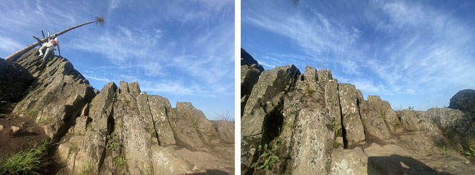
...multitude of overlapping basalt terraces:the largest contiguous volcanic region in Central Europe with an area of 2,500 square kilometres: Vogelsberg/Hesse/GER
The Vogelsberg Volcano Region Nature Park
- Naturpark Vulkanregion/High Vogelsberg Nature Park
-
...mainly basaltic lava and pyroclastic deposits were formed - GPSN 50°29'45.0'' E 9°12'10.9''
"From Andes to Himalaya, from the Great Divine Range to the Western Ghats, from Atlas Mountains to Sierra Madre Occidental, from the Rocky Mountains to Kilimanjaro and simply from the Alps to
Bilstein/Vogelsberg."
powered by J.R. Skye/Mona-Liza
"From Mexico (Cobá, Chichén Itzá & Tulum) via Guatemala (Tikal), Panama & Venezueala to Colombia. From Peru & Chile to Bolivia & Argentina and from the Drake Passage to the Antarctic."
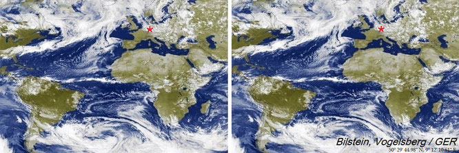
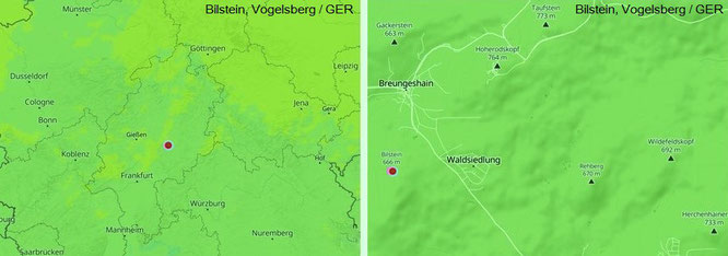
Bilstein, Vogelsberg / GER - 50° 29′ 44.98″ N, 9° 12′ 10.61″ E
Bilstein, Vogelsberg / GER - 50° 29′ 44.98″ N, 9° 12′ 10.61″ E - 50.495828°, 9.202949°
"You have to go the gradient differently: measure the optimal speed and the best gear at the bottom of the hill, and than go with a round footstep and like always with high frequency."
...in the midst of the largest contiguous volcanic region in Central Europe: at the bottom of Bilstein (666 m)/VB - 60 km
northeast of Frankfurt - with a view to Hoherodskopf (763,8 m), the second highest peak ofCentral Europe's largest basalt formation@Mona-Liza
...highest peak: Taufstein (773 m).
Bilstein, Vogelsberg / GER - 50° 29′ 44.98″ N, 9° 12′ 10.61″ E
...in the event of danger or in certain critical situations: the forces of nature keep you moving almost without your conscious effort. Get ready for it!
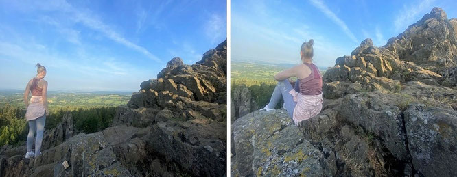
Bilstein, Vogelsberg - 50° 29′ 44.98″ N, 9° 12′ 10.61″ E. The beautiful shapes of the landscape as well as the imposing Bilstein are perfect for...team building activities.
Vogelsberg - multitude of overlapping basalt terraces: Bilstein/GER - 50° 29′ 44.98″ N, 9° 12′ 10.61″ E
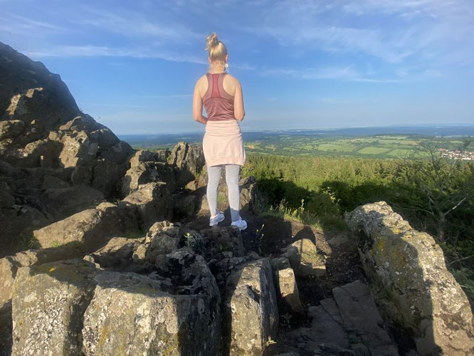
...an amazing chance to experience an alpine environment without being a climber: Bilstein, Vogelsberg - 50° 29′ 44.98″ N, 9° 12′ 10.61″ E
Bilstein, Vogelsberg / GER - 50° 29′ 44.98″ N, 9° 12′ 10.61″ E
High Points of Vogelsberg
- Taufstein (773.0 m, Rhine-Weser watershed) - Hoherodskopf (763.8 m) - Sieben Ahorn (752.7 m, Rhine-Weser and Main-Lahn watershed) - Herchenhainer Höhe (733.1 m,
Rhine-Weser watershed) - Geiselstein (ca. 720 m) - Nesselberg (ca. 716.2 m) - Wildefeldskopf (692 m) - Rehberg (670 m) - Bilstein (665.5 m) - Gackerstein (663 m) - Ernstberg (626 m) -
Eckmannshain (622.0 m) - Schlossberg Ulrichstein (609.7 m).
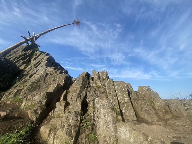
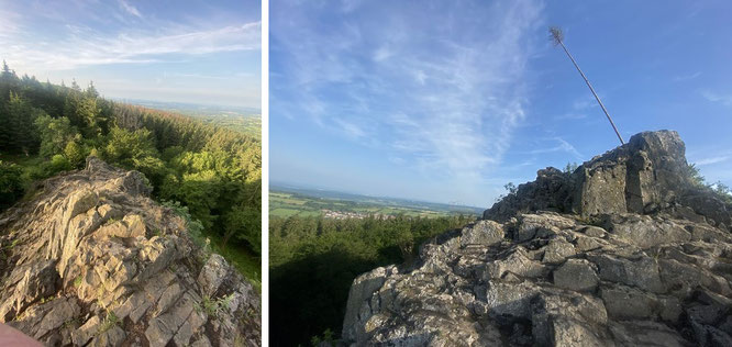
Rolling Stones? You can see one of my cameras gigantically haunted on the (standing) Stones of Bilstein, Vogelsberg - 50° 29′ 44.98″ N, 9° 12′ 10.61″ E
Bilstein, Vogelsberg - 50° 29′ 44.98″ N, 9° 12′ 10.61″ E
Bilstein, Vogelsberg - 50° 29′ 44.98″ N, 9° 12′ 10.61″ E
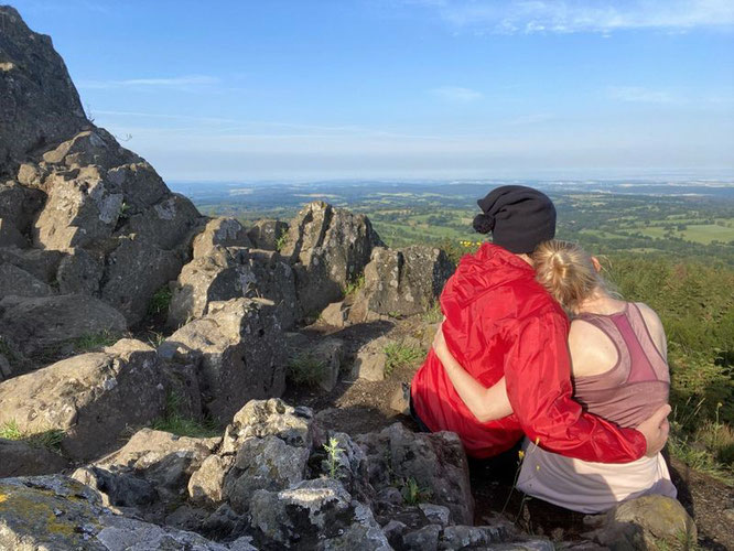
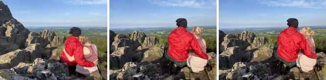
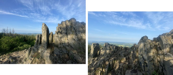
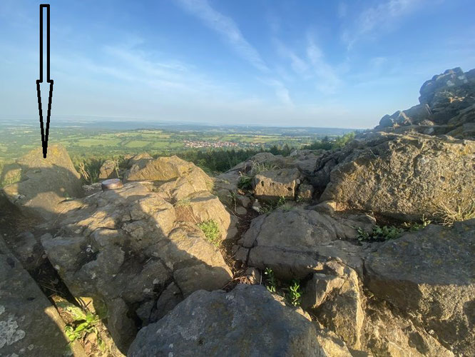
...appreciate the magnificent landscape of this volcanic region. Bilstein, Vogelsberg - 50° 29′ 44.98″ N, 9° 12′ 10.61″ E
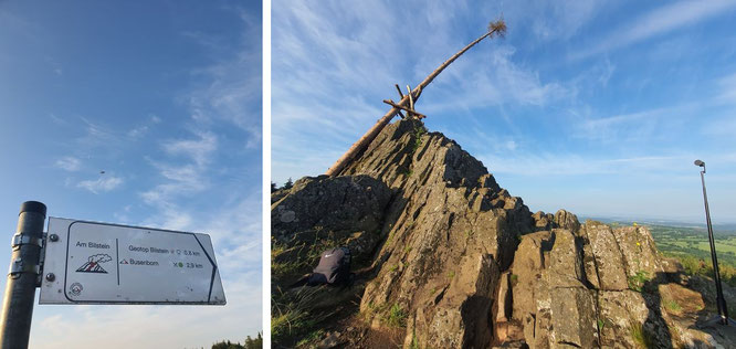
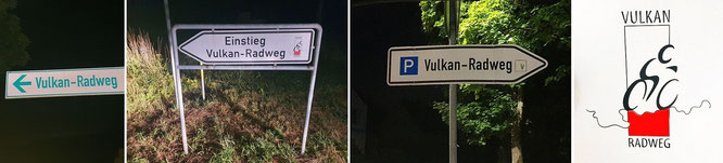
...take the short signposted trail (0,8 km) from "Parkplatz Segelflugplatz" between Breungeshain and Sichenhausen (L 3338) to Bilstein, Vogelsberg - 50° 29′ 44.98″ N, 9° 12′ 10.61″ E
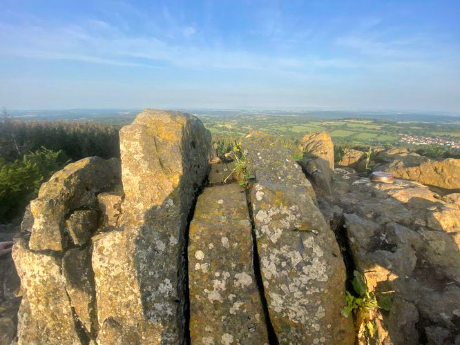
...direction of view: Freiensteinau, Lichenroth, Wüstwillenroth (Birstein), Schlüchtern, Sinntal. Bilstein, Vogelsberg / GER - 50° 29′ 44.98″ N, 9° 12′ 10.61″ E.
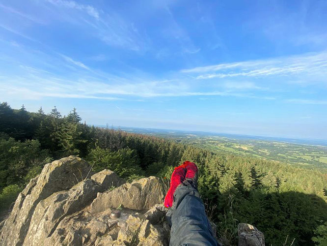
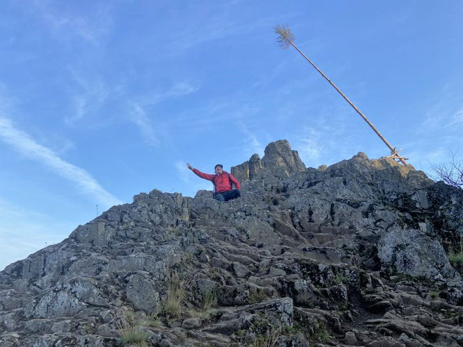
Get a 666 m. breath of air without exposing yourself to unspeakable physical exertion. Relax - on the top of Bilstein, Vogelsberg!
Bilstein, Vogelsberg - 50° 29′ 44.98″ N, 9° 12′ 10.61″ E
Bilstein, Vogelsberg - 50° 29′ 44.98″ N, 9° 12′ 10.61″ E
Bilstein, Vogelsberg - 50° 29′ 44.98″ N, 9° 12′ 10.61″ E
Bilstein, Vogelsberg - 50° 29′ 44.98″ N, 9° 12′ 10.61″ E
Bilstein, Vogelsberg - 50° 29′ 44.98″ N, 9° 12′ 10.61″ E
Bilstein, Vogelsberg - 50° 29′ 44.98″ N, 9° 12′ 10.61″ E
Bilstein, Vogelsberg - 50° 29′ 44.98″ N, 9° 12′ 10.61″ E
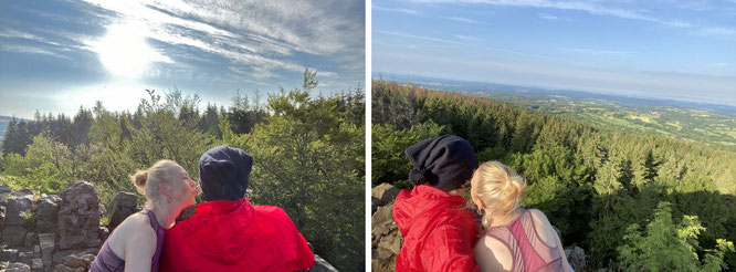
...north & south: embrasser see'est Francais; french kissin' at Bilstein, GER
...on the summit of Bilstein, Vogelsberg (666 m) / GER - 50° 29′ 44.98″ N, 9° 12′ 10.61″ E
...purple on one day, slate on another day, more blue on another day and maybe more red on another day. Rocky Mountain in the morning sun, exactly a year before: Bilstein, Vogelsberg...
Peak hiking: Bilstein, Vogelsberg - 50° 29′ 44.98″ N, 9° 12′ 10.61″ E
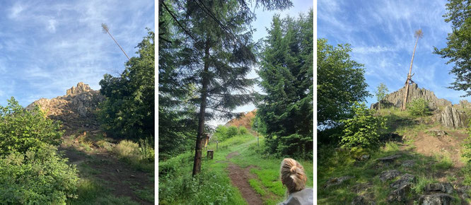
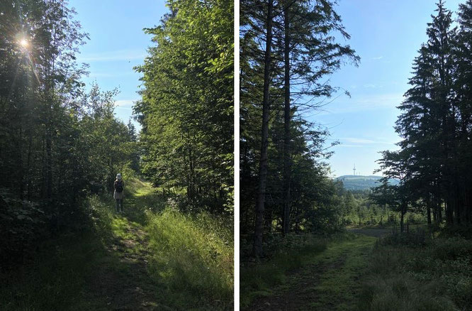
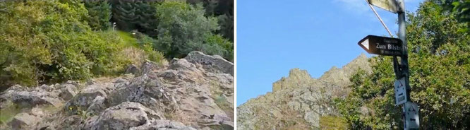
...at the foot of Bilstein. Start walking uphill, this is what the climb looks like.
Take a short walk of 15 minutes. Well-formed track, easy walking for up 10 minutes. In the last 5 minutes, the track is mostly well formed, but rising sharply.
Moderate walking!
A shelter just before the summit: Schuchardt-Hütte, Bilstein.
...a dream within a dream.
Sign o' the Times...can really blow your mind: but - not in this event. Straight ahead...and trust the plan!
Bilstein, Vogelsberg - 50° 29′ 44.98″ N, 9° 12′ 10.61″ E
Bilstein, Vogelsberg - 50° 29′ 44.98″ N, 9° 12′ 10.61″ E
Bilstein, Vogelsberg - 50° 29′ 44.98″ N, 9° 12′ 10.61″ E
...Hoherodskopf sublimely protrudes up and out of Vogelsberg, and you can enjoy a walk throug the "lush tropical" flora and fauna, perhaps in the company of colourful butterflies...
...or right among these friends - between Bilstein, Hoherodskopf and Taufstein.
Basecamp: from this parking spot it goes to the Bilstein in 15 minutes - 50° 30′ 1″ N, 9° 13′ 8″ E. Not only for those with moderate fitness...
Vogelsberg: German Central Uplands in the state of Hesse, Counties of Vogelsbergkreis, Main-Kinzig-Kreis, Wetteraukreis, Gießen and Fulda
...from Busenborn can also be hiked: 5,5 km and 6,8 km to the peak of Bilstein.
The Schotten-Breungeshain Waldsiedlung stop is the nearest to Bilstein
ALTVB-60 Schotten-Eichelsachsen Backhaus
VB-60 Schotten Gesamtschule
VB-94 Glauburg-Stockheim Glauburg-Stockheim Bahnhof
...from Bilstein to Hoherodskopf - 50° 29′ 44.98″ N, 9° 12′ 10.61″ E
Hoherodskopf - 50° 30′ 39.6″ N, 9° 13′ 37.2″ E
...volcanic mountain range of Vogelsberg, main peaks (highest: 773.0 m/2,536.1 ft), within High Vogelsberg Nature Park - 50° 31′ 12″ N, 9° 13′ 48″ E
Lakes and reservoirs of the Vogelsberg
- Antrift Reservoir - Gederner See - Nidda Reservoir - Mooser Teiche - Storage basin of the Nidder Power Station
Main rivers of the Vogelsberg
Fulda: - Schwalm (97.1 km) - Antrift (38.6 km) - Schlitz (43.3 km) - Lauter (27.9 km) - Brenderwasser - Altefeld (30.0 km) - Lüder (36.4 km) - Giesel (7.2 km) -
Fliede (22,1 km)
Main: Kinzig (86.0 km) - Steinaubach (23.2 km) - Ulmbach (13.4 km) - Salz (29.8 km) - Bracht (31.5 km) - Nidda (89.7 km) - Seemenbach (37.4 km) - Nidder (68.6 km) -
Horloff (44.5 km) - Wetter (68.8 km) - Ohm (59.0 km)
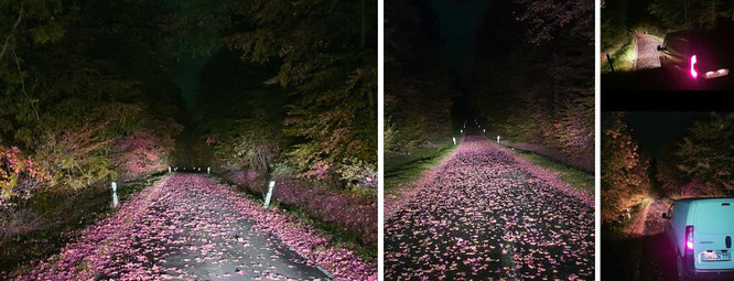
Indian Summer (late October) in Vogelsberg: between Lauterbach-Frischborn & Dirlammen (Lautertal)...with two of my vans (loaded with Mountaineering Gear) @国强_北京 @AvaT_NYC. Approaching Bilstein...
Your ticket: entrance to the peak of Bilstein after your 15 minutes walk from Parkplatz "Waldsiedlung/Geotop Bilstein", Segelflugplatz, Schotten-Breungeshain, L3338...
See you and good bye...from Bilstein, Vogelsberg
Dear friends on the other side of the Atlantic- and Pacific ´O: